

AlpineQuest Off-Road Explorer
Use LDPlayer to Play AlpineQuest Off-Road Explorer on PC
AlpineQuest Off-Road Explorer is a Maps&Navigation application developed by Psyberia, but with the best Android emulator-LDPlayer, you can download and play AlpineQuest Off-Road Explorer on your computer.
Running AlpineQuest Off-Road Explorer on your computer allows you to browse clearly on a large screen, and controlling the application with a mouse and keyboard is much faster than using touchscreen, all while never having to worry about device battery issues.
With multi-instance and synchronization features, you can even run multiple applications and accounts on your PC.
And file sharing makes sharing images, videos, and files incredibly easy.
Download AlpineQuest Off-Road Explorer and run it on your PC. Enjoy the large screen and high-definition quality on your PC!
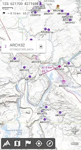
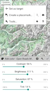
Screenshots and Videos of AlpineQuest Off-Road Explorer on PC


Why Play AlpineQuest Off-Road Explorer on PC with LDPlayer?
How to Download AlpineQuest Off-Road Explorer on PC?
Download and install LDPlayer on your computer
Locate the Play Store in LDPlayer's system apps, launch it, and sign in to your Google account
Enter "AlpineQuest Off-Road Explorer" into the search bar and search for it
Choose and install AlpineQuest Off-Road Explorer from the search results
Once the download and installation are complete, return to the LDPlayer home screen
Click on the game icon on the LDPlayer home screen to start enjoying the exciting game
If you've already downloaded the APK file from another source, simply open LDPlayer and drag the APK file directly into the emulator.
If you've downloaded an XAPK file from another source, please refer to the tutorial for installation instructions.
If you've obtained both an APK file and OBB data from another source, please refer to the tutorial for installation instructions.
In its various iterations, this has been one of the most consistently useful and valuable android apps I've ever used. It alone made owning a smartphone a worthwhile investment when I first purchased the pro version of the app years ago, and that appraisal remains equally apt today. Loads of useful maps available for use offline. Robust yet intuitive interface. Regular updates and functional improvements. And (hallelujah!) a one-time-purchase model at a very reasonable price point. Kudos!
Fantastic app for bike packing, hiking, dual sport motorcycling. If you dig into the app you can plot trips beforehand telling you elevations between way points, mileage, insert highlighted areas anywhere. Maps are precise and accurate. Works great in airplane mode. Basically you are wherever the dot is and you can plot distances from there. I'm not a GPS geek I just want something that works, easy to use and is accurate. Could care less what Joe blow did and if he had a good time. 5 stars
Works well, I am happy to have paid for the full version. Includes trail layers and ability to preplan a route, along with easy to download Japan GSI maps. There is a bit of a learning curve and I am not sure I have figured out how to use it optimally, but overall it suits me well. The real-time location saved me a couple times when I went off trail.